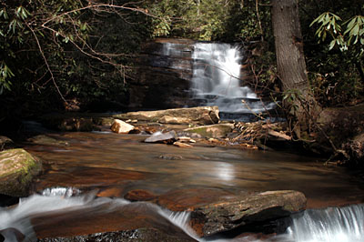
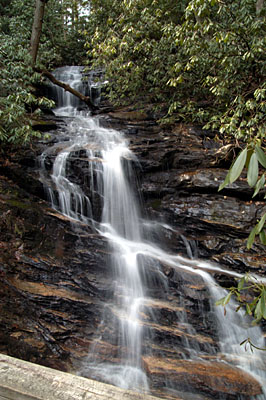
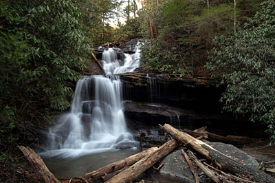
 Drove up to Tallulah Falls and then to Clayton, took pictures of three waterfalls, Stonewall in Tallulah Falls, and then Becky Creek Falls and Martin Creek Falls by the Warwoman Dell just east of Clayton. Drove up to Tallulah Falls and then to Clayton, took pictures of three waterfalls, Stonewall in Tallulah Falls, and then Becky Creek Falls and Martin Creek Falls by the Warwoman Dell just east of Clayton.
The Stonewall Falls was a very short hike on a road to a campsite at the base of the falls. There was a lot of trash around the site and I picked up some beer cans and a MacDonalds bag, sad part is that just at the parking area there was a trash can and people couldn’t even throw it there. They had some nice mountain bike trails and may have to bring my bike sometime. |
 Next, I stopped at the Warwoman Dell and plodded up to the Becky Creek Falls, this was on the Bartram Trail that winds accross Warwoman Rd and then a rather steep but short distance to the bridge/viewing deck. The trail continues around back to Warwoman Rd. You could cut some of the walk out if you just pulled off the side of the road (on the left if you are traveling out of Clayton) just before reaching the Dell entrance on the right. |
 The last falls I had time for was the Martin Creek Falls, just down the road from Warwoman Dell, off a Forestry Service road I parked at a campsite and then headed out trying to look for the trail. I crossed the creek as the directions said and then lost sight of any trail. I continued for some time just following the creek but ended up in a very steep area and decided to try another route before I got into something I would regret. I went back to the car, attached the GPS to my pocket pc and started following the signal, I was only about 1800 feet from the falls. I ended up at the road farther down that where I parked and found another campsite who’s entrance was blocked by a mound of dirt. After going down to the site by the creek I found the elusive forestry service trail and after a very short walk found the waterfall. By this time it was around 4:30pm and I headed back deciding to try to find the way back using the trail. I ended up walking this trail, for about 1 mile before pulling out the GPS and finding I was at least .75 milles farther down the valley than I wanted to be. I back-tracked and realized that there was a split in the trail where a large branch was placed that led to the area I wanted to be in and soon found the place I had originally crossed the creek on my first outing. HOME AT LAST! |
Aaron Walton
"I may be drunk, but in the morning I'll be sober and you'll still be ugly." - Winston Churchill
Loading images...

